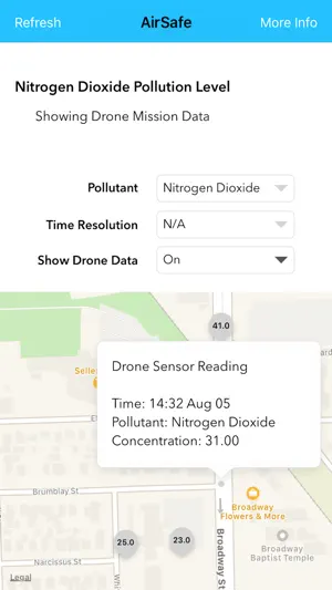
AirSafe is a Houston-based project that provides both live and historical readings of pollutant levels in the atmosphere.
Live Data
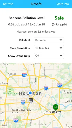
The top half of the display shows your distance to the nearest gas sensor, along with the live reading from that sensor. AirSafe then helps you interpret what that pollution level means by showing safety thresholds.
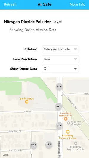
Sensor Map
A map shows all of the sensor locations as pins with the measured pollution level at that sensor.
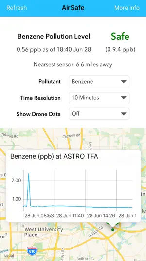
Historical Data
A graph of a sensor's past observations can be pulled up by tapping on the corresponding marker on the map.
About the Project
The AirSafe app is part of the community-facing end of a collaborative project by Rice University. The project hopes to provide useful, high granularity data about the gases in the atmosphere to both researchers and members of the community.
Note that the data in this app focuses on the Houston area.
版本更新内容:- Support for multiple pollutants, including BTEX gases and NO2\n- Data from drone missions

人体益智游戏-科学启蒙总共10款应用
人体益智游戏是一款趣味科普教育游戏,让孩子们轻松学到人体器官和人体如何运转。人体由许多部分组成。对这些部位的研究称为解剖学。身体

EGLV FloodCheck
天气Gfr?r.li
天气Agriculture Farming Weather
天气地震 SW
天气Crosswind Calculator Pro
天气
KPRC 2 Storm Tracker
天气FishTrack - Charts & Forecasts
天气
晴雨表 - 大气压力
天气
Fay Hatt?m
天气实时台风路径
天气